Google Earth: Supertool in Vehicle Accident Reconstruction

Speed Determination in Vehicle Accident Reconstruction
February 9, 2026
Limits on Expert Witnesses… Not All Are A Bad Thing!
February 15, 2026
Using Google Earth for Measurements in Vehicle Accident Reconstruction
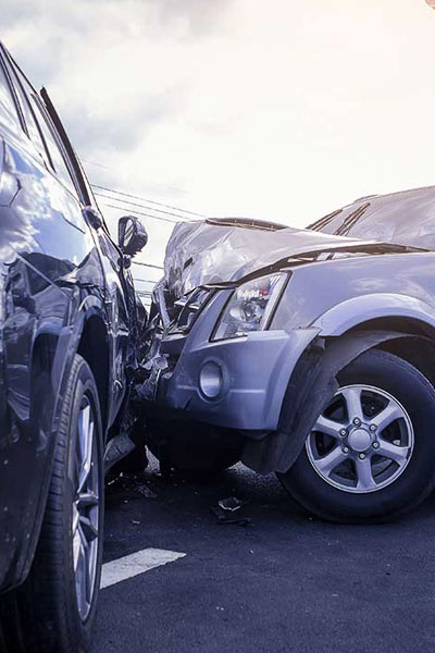
Vehicle accident reconstruction often requires precise measurements of distances, such as skid marks, sight lines, lane widths, point of impact to final rest positions, or visibility obstructions. Google Earth (particularly the Pro version) offers a cost-effective, accessible means to obtain quality measurements for many cases. It has become a recognized tool in forensic and legal contexts, supported by research validating its accuracy for typical reconstruction distances.
Why Use Google Earth in Accident Reconstruction?
- Historical Imagery: Prior views can be used to correspond to conditions at or near the time of the incident.
- Cost and Time Savings: Preliminary assessments can be made, and sometimes a full analysis can be completed with no site visit.
- Visual Context: Combine measurements with overhead views, 3D terrain, and street-level perspectives for diagrams and reports.
- Integration: Data can be exported to reconstruction software.
Studies, including SAE papers from 2015 and 2017, confirm Google Earth Pro’s reliability. One analysis of over 1,300 measurements across diverse locations found low error rates, often under 1% for distances over 50 feet, making it suitable for many on-road applications.
Key Measurement Tools in Google Earth
Google Earth Pro (free for personal and professional use) provides advanced tools compared to the basic web version.
- Ruler Tool (Primary for distances):
- Measures straight lines or curved paths.
- Use “Ground length” to account for terrain.
- Units: Switch between feet, meters, etc.
- Path Tool: For following curved trajectories, like vehicle yaw marks or curved roadways.
- Historical Imagery: View past dates to select the closest match to the accident date.
- 3D Buildings and Terrain: Enable for better visualization of sight lines or elevation changes.
Accuracy Considerations
Accuracy varies by location, image resolution, and user technique:
- Typical Errors: Research shows root mean square errors around 0.5–1 foot for short distances (<50 ft), improving percentage-wise for longer ones (e.g., <0.5% average error over 100+ ft on paved roads).
- Best For: On-road paved surfaces, intersections, and distances up to thousands of feet.
- Limitations: Poorer in rural/off-road areas, heavy tree cover, or recent changes. Short measurements (<25 ft) can have higher relative error due to pixel limitations. Always document image date and source.
- Best Practices: Use zoomed-in tilted views, precise point selection, and ground-length mode. For critical cases, supplement with field verification.
Conclusion
Google Earth enables almost anyone to access geospatial measurements for vehicle accident reconstruction. When used diligently it provides reliable data that can streamline investigations and support expert analyses. It may not be a replacement for high-precision surveying in all cases, but its accuracy makes it an indispensable tool for modern reconstructionists. Always cite the imagery date and cross-reference where possible for courtroom admissibility.
https://www.linkedin.com/posts/edcarrick_google-earth-supertool-in-vehicle-accident-ugcPost-7427207717251092480-54xq?utm_source=share&utm_medium=member_desktop&rcm=ACoAAAGloH4ByZEBSySB4j9aMnsSTNBqFWj4pMY

