Why Drones are So Powerful in Vehicle Accident Reconstruction

Key Pointers for Attorneys Hiring a Vehicle Accident Reconstruction Expert
February 5, 2026
Speed Determination in Vehicle Accident Reconstruction
February 9, 2026
The Application of Unmanned Aerial Vehicles in Vehicle Accident Reconstruction
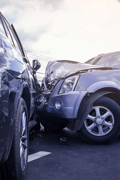
Vehicle accident reconstruction includes the analysis of evidence to determine collision physics, velocities, directions, and other factors. Traditionally, manual tape measures, total stations, and ground-level photography- all labor intensive, liable to human error, and dangerous among moving vehicles- were used to document crash scenes or sites.
The use of unmanned aerial vehicles (UAVs), or drones, has enhanced the process through rapid aerial data capture. Drones equipped with high-resolution cameras provide overhead perspectives that ground methods cannot match, allowing for faster scene mapping while minimizing road closure times and personnel risk.


The core technical methodology utilizes photogrammetry, compiling hundreds of overlapping drone images, taken during orbital or grid flights. The images are processed using specialized software (e.g., WebODM, Meshroom, Pix4D, PhotoModeler, or FARO Zone) to create accurate orthomosaic maps and dense 3D point clouds. The point clouds can be used, often in conjunction with photo-derived “textures”, to create realistic and measurable 3D models of crash sites, vehicles, and other relevant items. When combined with real-time kinematic (RTK) GNSS for georeferencing, these outputs achieve centimeter-level positional accuracy. Drones with LiDAR instruments further enhance capability by producing direct high-density point clouds that capture fine surface details, such as skid marks or vehicle crush deformation, which can be fused with photogrammetric models for hybrid 3D models.
Drones offer significant advantages over conventional data capture. Flight times for complete site coverage can range as low as 5 to 20 minutes, compared to hours for manual methods, enabling more efficient scene capture and reduced secondary collision risks. The aerial vantage point documents spatial relationships—such as vehicle orientations, debris distribution, and roadway geometry—with greater completeness and objectivity. This efficiency has been shown to reduce on-scene time significantly, improving traffic management and investigator safety, all while producing court-admissible products like scaled diagrams and 3D models, and even animations.
Despite these benefits, there are sometimes limitations to consider. Drones are sensitive to adverse weather, including high winds or precipitation. Regulatory constraints such are FAA airspace rules) requirements and the need for drone pilot licensure may also restrict deployment. Battery life limits mission duration, although automated battery swaps typically overcome this issue. Data processing requires enhanced computational resources and trained personnel to ensure accuracy. Low-light or dynamic conditions can degrade photogrammetric quality, necessitating supplementary ground control points or validation against laser scans.
Operator certification and standardized protocols are essential to ensure proper workflow and to retain product reliability.

In summary, drones or UAVs represent a powerful tool in vehicle accident reconstruction, delivering superior speed, safety, and precision through photogrammetry and/or LiDAR integration. As equipment technology advances, drones will become increasingly standardized in forensic workflows, enhancing the precision of crash investigations and providing better answers to liability and causation.
If an expert or team properly utilizes drone technology in vehicle accident reconstruction, one can almost be certain the resulting work product will be of high quality and poised to present to the court the realities of the subject incident.
www.performanceanalysisllc.com

